After a brief visit to Lebanon last week, the US energy envoy Amos Hochstein sent to the Lebanese officials a map that shows the maritime Blue Line demarcated by the United Nations and about which Lebanon expressed reservations.
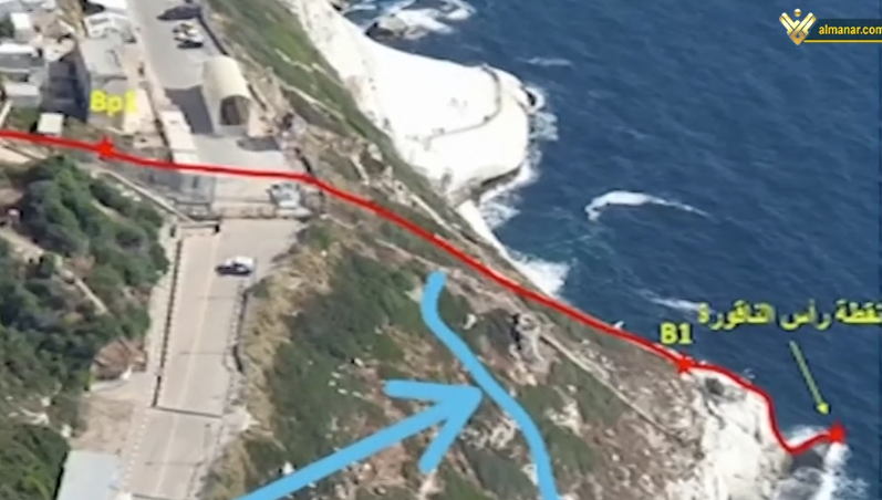
In details, the strategic expert Amin Hoteit told Al-Manar that Lebanon’s terrestrial borders in Naqoura area occur at B1 position which overlooks Rosh Hanikra touristic area.
The Zionist enemy wanted to control the B1 zone in order to “secure” the touristic area, so it demanded amending the borders, according to General Hoteit.
General Hoteit indicated that what was more dangerous was that changing the terrestrial border will be relied on to amend the maritime borders. Thus, Lebanon would lose a considerable part of its borders and resources.
Instead of resolving the remaining issues hindering the indirect agreement between Lebanon and ‘Israel’ to demarcate the maritime borders, the US mediator has recalled more points of dispute, which would complicate the scene and expose it to a potential military escalation.
Source: Al-Manar English Website


